Written by: Alena Cansery
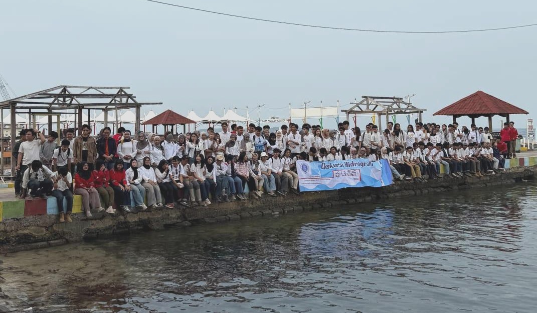
PRAMUKA ISLAND, KEPULAUAN SERIBU, INDONESIA – How do hydrographers measure the ocean and map the seafloor? These questions were explored by students during the Hydrography Practical Excursion 2026, held from 23 to 25 October 2026 at Pramuka Island, Kepulauan Seribu, Indonesia.
The three-day excursion provided an opportunity for students to apply theoretical knowledge through direct field observations, instrument operation, and hydrographic data acquisition. The programme consisted of eight practical modules covering tidal observations, bathymetric surveying, seabed investigation, coastal mapping, meteorological observations, and emerging survey technologies.
Through these activities, students experienced how different instruments and measurement techniques contribute to understanding and mapping the marine environment.
Exploring Eight Hydrographic Practical Modules
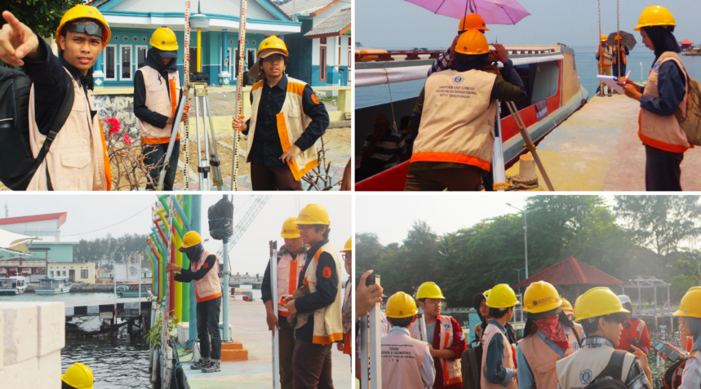
1. Tides and Transfer of Level (TOL)
The TOL module introduced students to tidal observations and vertical reference measurements. Participants conducted manual sea-level observations using a tide pole and automatic measurements using a Valeport pressure-based tide gauge. They also performed levelling measurements with a waterpass to determine the height difference between the tide pole’s zero level and a land-based reference point.
2. Single Beam Echo Sounder (SBES)
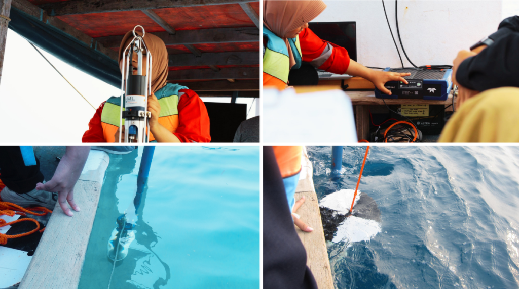
In this module, students learned the principles of acoustic depth measurement using the Echotrack E-20 SBES, owned by PT Pageo Utama. Activities included instrument familiarisation, bar check calibration, Sound Velocity Profile (SVP) measurement using SeaCast, and bathymetric data acquisition supported by a Trimble NetR9 GNSS receiver.
3. Multibeam Echo Sounder (MBES)
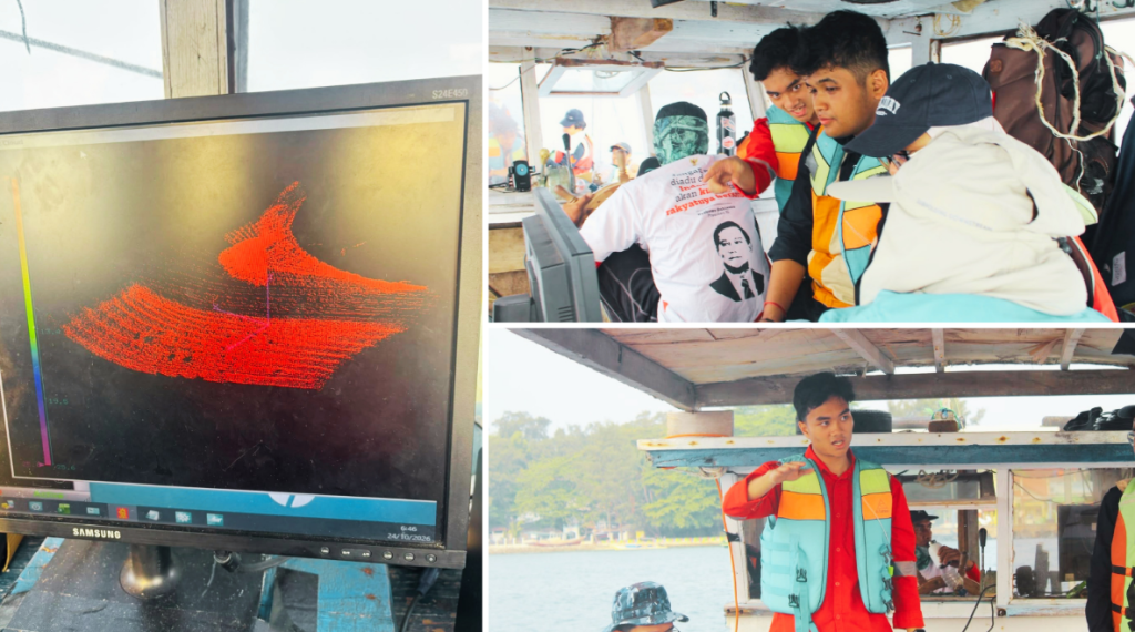
The MBES module introduced students to wider-area bathymetric mapping using the Kongsberg M3 multibeam sonar. Participants observed the integration of MBES with GNSS and IMU sensors and monitored real-time survey information, including vessel positioning, motion, and depth measurements. The activity demonstrated how multibeam measurements generate three-dimensional representations of the seabed.
4. Side Scan Sonar (SSS) and Sampling
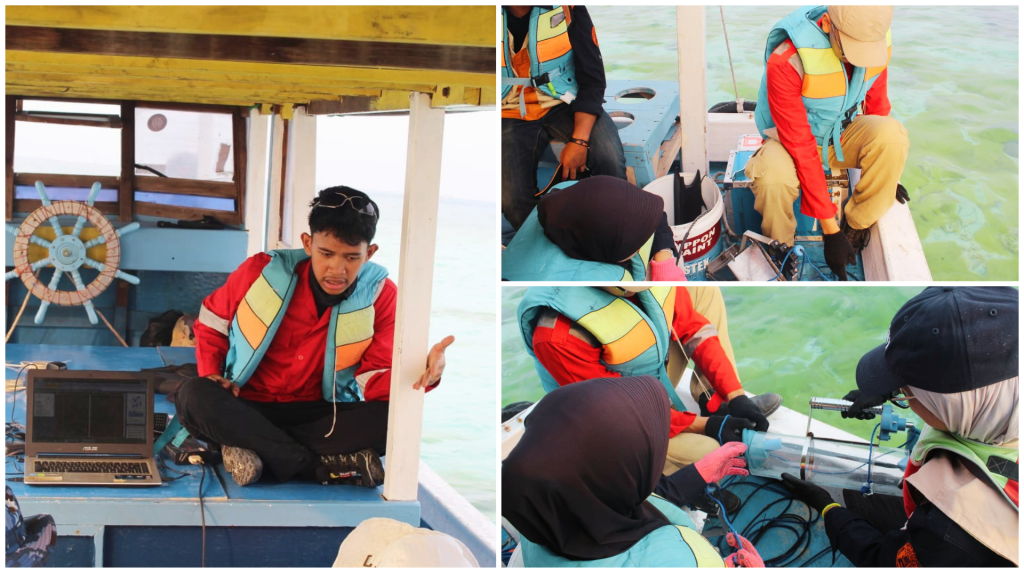
This module combined acoustic seabed imaging with direct environmental sampling. Students learned to operate SSS to identify underwater features and seabed characteristics. They also collected sediment and water samples using a Grab Sampler and Water Sampler to support the interpretation of seabed conditions.
5. Beach Profiling
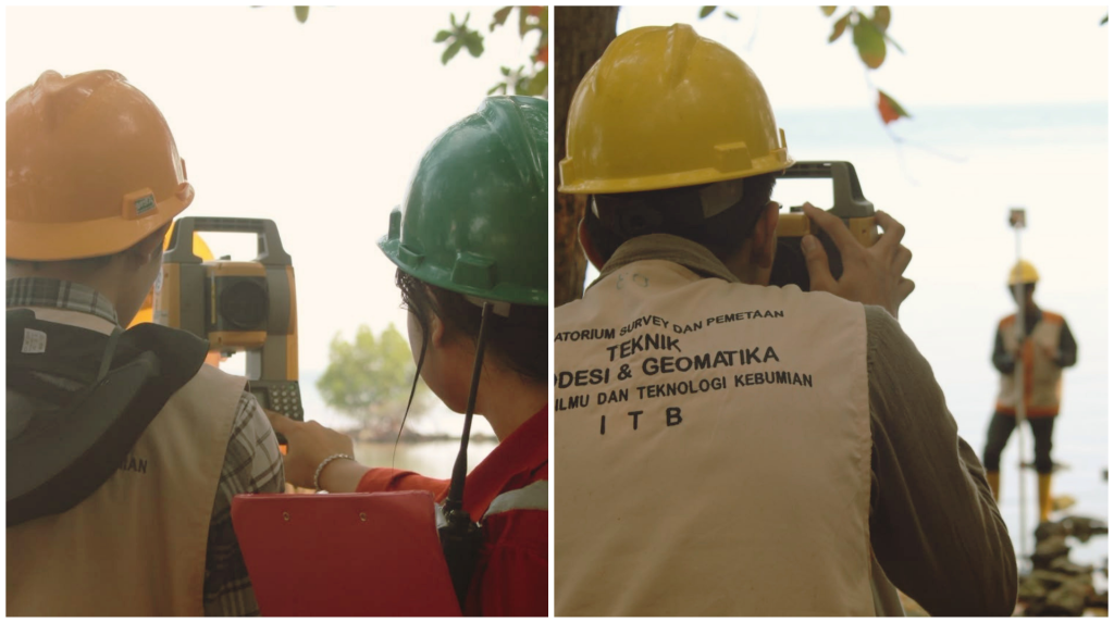
Students conducted coastal topographic measurements using an Electronic Total Station (ETS). Measurements were taken along cross-shore profiles to identify changes in beach elevation and slope. The resulting profiles can be combined with bathymetric data to provide a more comprehensive representation of the coastal environment.
6. Automatic Weather Station (AWS)
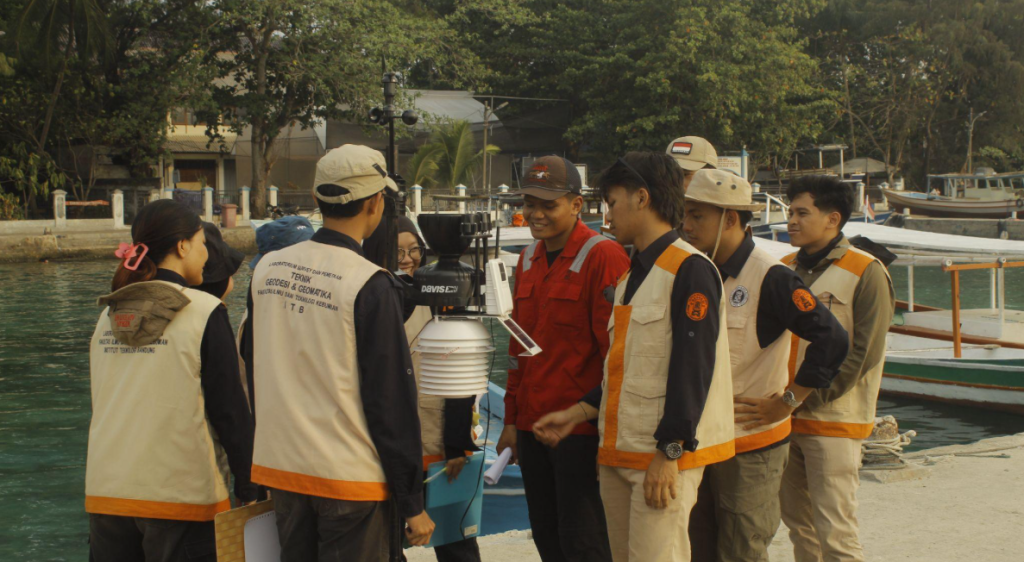
The AWS module introduced meteorological observations using the Davis Vantage Pro2. Students learned about the instrument components and recorded parameters such as wind speed, wind direction, air temperature, and atmospheric pressure at five-minute intervals. The collected observations were subsequently processed into a wind rose diagram.
7. Unmanned Surface Vehicle (USV)
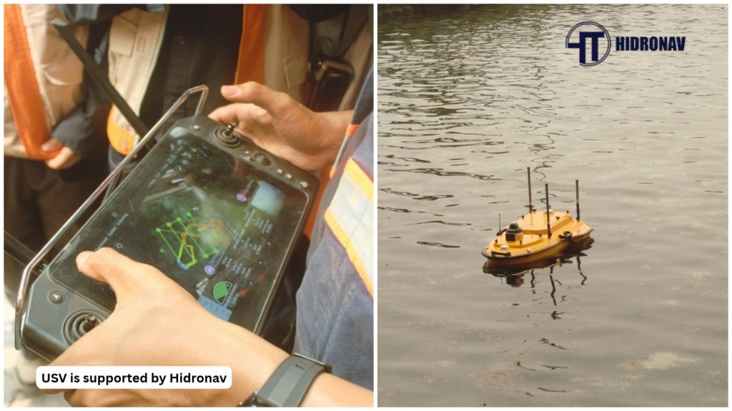
As a new addition to the 2026 excursion, the USV module introduced students to unmanned platforms for hydrographic surveying using a USV provided by Hidronav. Participants learned about survey-line planning, platform preparation, instrument configuration, and bathymetric data acquisition. The activity demonstrated the potential of USVs for surveying shallow-water areas.
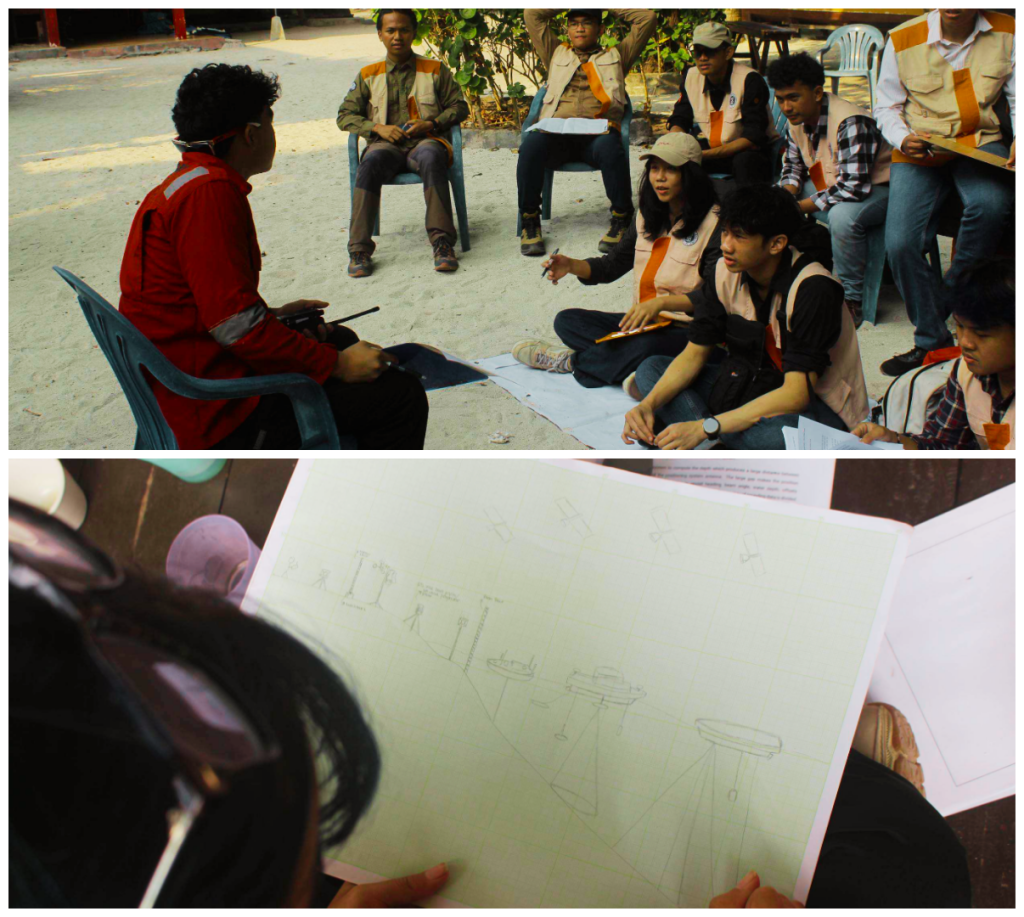
8. Sketching
The final module encouraged students to summarise their practical experience through technical sketches. Each group illustrated the instruments, their configurations, and their functions, demonstrating how different equipment and surveying techniques are connected throughout a hydrographic survey.
Bringing Theory and Practice Together
Across the three-day programme, students gained practical experience with a wide range of hydrographic instruments and surveying techniques. From tidal observations and acoustic bathymetric measurements to seabed imaging, coastal profiling, and autonomous survey technology, each module provided a different perspective on marine data acquisition.
For Hydrography ITB, the annual practical excursion represents an important part of field-based learning, bridging classroom knowledge with real-world surveying applications. Through direct interaction with instruments and collaboration during field activities, students developed a better understanding of how different measurements and technologies work together to support hydrographic surveying.